

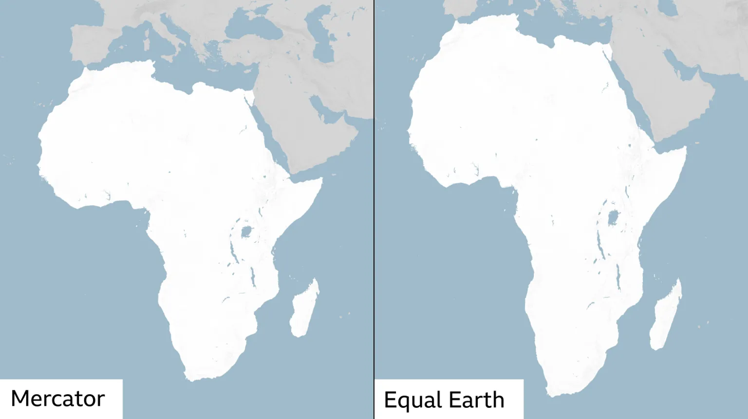
Kenya could soon appear more accurately represented on world maps, after the United Nations General Assembly adopted a resolution addressing long-standing distortions in how the country and the rest of Africa are depicted on commonly used maps.
The ‘Correct the Map’ resolution was adopted on Friday, September 4, with 164 countries voting in favour, one against and six abstaining. The initiative was brought forward by Togo on behalf of the African Group and backed by the African Union, having first been endorsed by the AU Assembly in February.

Kenya was among a large bloc of African nations supporting the resolution, alongside South Africa, Nigeria, Ghana, Egypt, Ethiopia, Tanzania, Uganda, Rwanda, Botswana, Zambia, Zimbabwe, Morocco, Algeria, Senegal and Côte d’Ivoire. France and the United Kingdom also voted in favour.
The United States was the only country to vote against the resolution, while Estonia, Georgia, Lithuania, Moldova, Serbia and Ukraine abstained.
At the heart of the resolution is a problem rooted in the Mercator projection, the map format that has dominated global cartography since it was devised by Flemish mapmaker Gerardus Mercator in 1569.
Because the projection stretches landmasses as they move away from the Equator toward the poles, countries near the Equator, including Kenya and much of Africa, end up appearing considerably smaller than they actually are, while countries closer to the poles appear larger.
The difference is clear; Africa is roughly 14 times the size of Greenland in reality, yet the two often appear similar in size on a standard Mercator map.
The resolution’s backers argue this is not merely a cartographic curiosity, warning that persistently depicting Africa and other equatorial regions as smaller than they truly are can subtly diminish global perceptions of their economic, geopolitical and development significance.
The resolution does not ban the Mercator projection outright, nor will it alter Kenya’s actual borders, land area or geographical shape. Instead, it encourages countries, schools, media organisations and international institutions to adopt map projections that more accurately reflect the true relative size of countries and continents, including equal-area alternatives such as the Equal Earth projection, developed by a team of cartographers in 2018.
The vote itself is non-binding, but is expected to gradually influence the maps used by governments, educational institutions and media organisations worldwide.
The African Union welcomed the outcome, congratulating Togo and the wider African Group for spearheading the initiative through to adoption.
Kenya too, described the vote as more than symbolic, describing it as a meaningful step toward correcting how Africa’s image and potential are perceived globally, rather than a purely cosmetic change to how maps are drawn.
Email your news TIPS to Editor@nairobilawmonthly.com, and to advertise with us, call +254715061658 anytime of the day
