

For months now, Kenyans have been hearing the phrase everywhere: on the news, in government briefings, in conversations about the coming short rains. El Nino. It is a word many associate vaguely with floods, but few could explain properly.
What actually is it? Why does it keep coming back? And with meteorologists now warning that the version heading Kenya’s way this time could be one of the strongest on record, what should ordinary people actually expect?

What El Nino actually is
El Nino is not a Kenyan weather event at all, at least not in origin. It begins thousands of kilometres away, in the tropical Pacific Ocean, off the coast of South America. Under normal conditions, strong easterly trade winds push warm surface water westward across the Pacific, allowing cooler water to rise up from the depths near Peru and Ecuador.
El Nino happens when those trade winds weaken, sometimes stall, or even briefly reverse. Without them pushing warm water away, it piles up instead in the central and eastern Pacific, raising sea surface temperatures well above normal.
That change might sound like a distant, purely oceanic event, but its effects ripple outward across the entire planet through what scientists call “teleconnections.” The extra heat and moisture rising off the warmer Pacific alters atmospheric circulation patterns far beyond South America, shifting rainfall belts, jet streams and storm tracks across Asia, Australia, the Americas and Africa.
According to Columbia University’s International Research Institute for Climate and Society, this single climate pattern, technically known as the El Nino-Southern Oscillation, or ENSO, is responsible for as much as half of all year-to-year climate variability in some parts of the world.
Peruvian fishermen centuries ago noticed that every few years, unusually warm coastal waters would arrive around Christmas time, disrupting the usual cold-water upwelling their livelihoods depended on. They called it “El Nino”, Spanish for “the little boy”, a reference to the Christ Child, since the warm currents tended to peak in December.
Scientists later discovered the phenomenon was part of a larger, recurring cycle that swings between El Nino’s warm phase and its opposite, La Nina, when Pacific waters turn unusually cool instead. Together, these alternating phases are what climate scientists monitor using the Oceanic Nino Index, tracking how far Pacific sea temperatures depart from their long-term average.
El Nino events are not rare. At least 27 were recorded across the 20th century alone, occurring roughly every two to seven years and typically lasting nine to twelve months once established. What varies is their strength, and it is that strength which determines just how disruptive, or mild, any given event turns out to be for a country like Kenya.
Kenya’s painful history with El Nino
For Kenyans old enough to remember it, the 1997-98 El Nino remains the benchmark against which every subsequent warning is measured. It was, by scientific consensus, among the most powerful ENSO events ever recorded, and its effects on Kenya were severe.
Between October 1997 and February 1998, most parts of the country received between two and twelve times their normal monthly rainfall. The consequences were exactly what that number suggests: widespread flooding and landslides, destroyed roads, bridges and airstrips, and displaced communities across the Coast, North Eastern and Eastern regions in particular.
In northeastern Kenya, floodwaters submerged large sections of the Dadaab refugee camps, cutting off access entirely as roads and airstrips disappeared underwater.
Kenya’s agricultural sector alone lost an estimated $236 million (approximately Sh30 billion), roughly one-tenth of the country’s entire economic output that year. Rift Valley fever broke out in the aftermath of the flooding, alongside surges in cholera and malaria, illnesses that thrive whenever clean water systems and sanitation infrastructure break down at scale.
Globally, the 1997-98 event is estimated to have caused economic losses of around $5.7 trillion within five years, and killed off an estimated 16 per cent of the world’s coral reef systems through ocean warming.
More recently, the 2023-24 El Nino delivered a similarly harsh reminder of what these events can do. Enhanced rains beginning in October 2023 continued into early 2024, followed by an exceptionally heavy March-to-May long rains season the same year.
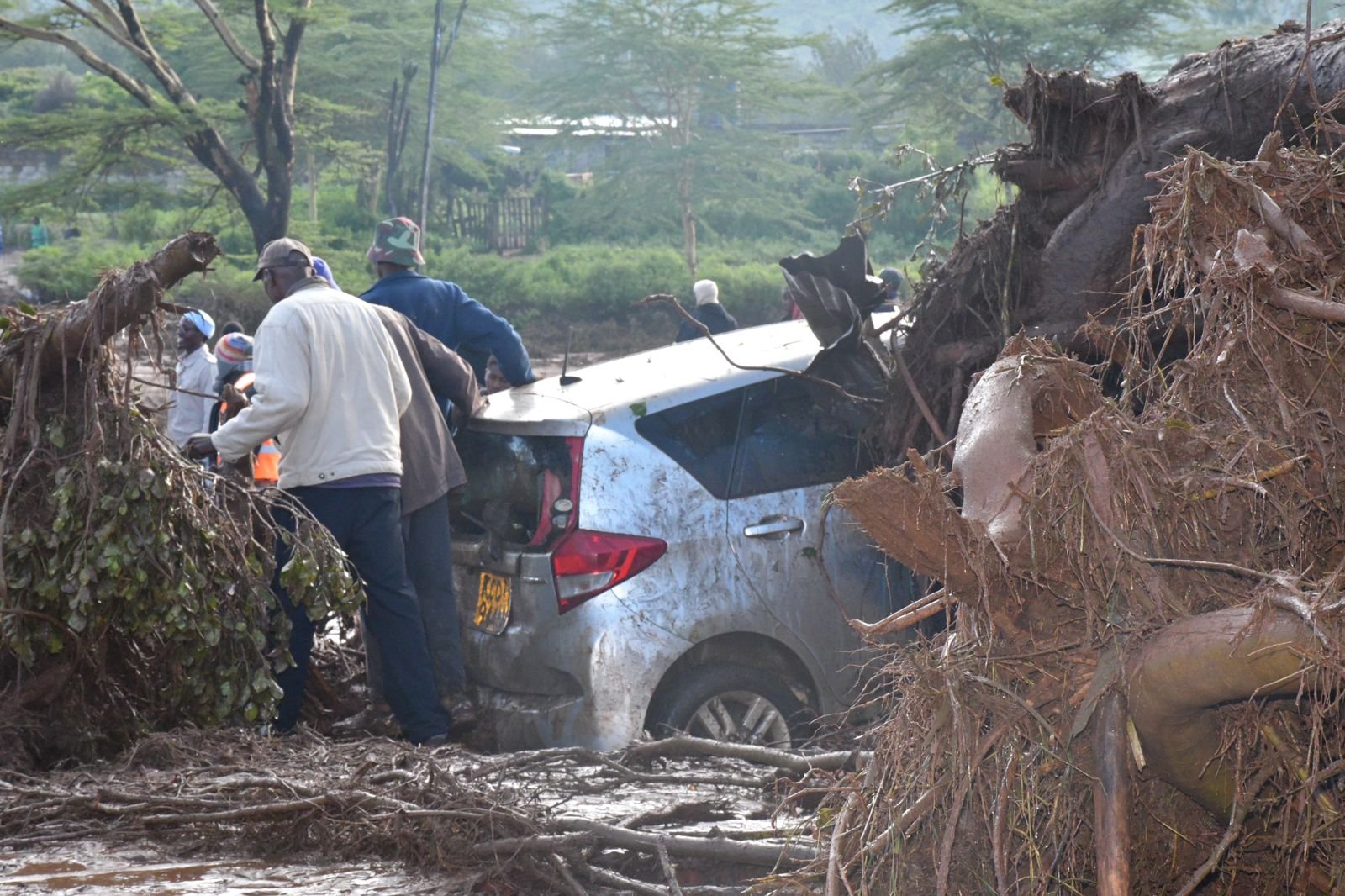
Counting both phases together, Kenya’s death toll from that single extended episode climbed past 290, with over 500,000 households displaced nationwide, more than 13,400 livestock killed and upwards of 17,000 acres of farmland destroyed. A makeshift dam bursting its banks near Mai Mahiu in April 2024 became one of the tragedy’s most devastating single incidents.
Forty-two of the country’s 47 counties were affected in some way. Sixty-three health facilities across eleven counties were damaged or cut off entirely, and cholera cases began climbing in Tana River County as clean water access collapsed.
Why this next one has officials worried
Kenya’s own weather authority began flagging concern as early as June this year. In a statement issued on June 9, the Kenya Meteorological Department said global models were showing an 80 to 82 per cent likelihood of El Nino developing during the June-to-August period, with the probability of it persisting through to the end of 2026 climbing to between 90 and 96 per cent.
By July, that picture had sharpened further. Hannah Kimani, Head of Public Weather Services at Kenya Met, told the press there was now an 81 per cent chance the 2026 event would develop into a “very strong” El Nino, and a 97 per cent chance its effects would persist into early 2027.
What makes forecasters particularly concerned is not simply El Nino on its own, but its interaction with a second climate pattern, the Indian Ocean Dipole, or IOD. When the IOD turns “positive”, meaning waters in the western Indian Ocean run warmer than normal, it tends to amplify East Africa’s rainfall on top of whatever El Nino itself is already delivering.
Meteorologists say the IOD turned positive around August this year, precisely the combination that produced the extreme, disaster-level rainfall of both 1997-98 and 2023-24.
Kenya Met’s outlook points to October and November as the months when the strongest rainfall signals are likely to arrive, with above-average rainfall expected to persist into December and, in some models, stretch into the opening months of 2027.
The Kenya Meteorological Service has specifically identified three distinct flood risks the country needs to prepare for this time: riverine flooding along major rivers, flash flooding in areas with sparse vegetation, such as Wajir and Mandera in the north, where heavy rain generates rapid surface runoff, and urban flooding in cities including Nairobi, Mombasa and Kisumu, where drainage systems routinely struggle to cope with intense rainfall. Tana River and Garissa counties have also been separately flagged as particularly likely to flood.
Kenya Met officials have also noted that a strong El Nino does not automatically guarantee catastrophic rainfall everywhere. KMSA climate scientist Hannah Kimani has cautioned against viewing El Nino purely as a flood signal, noting that the ultimate scale of rainfall depends on multiple interacting factors, not the strength of El Nino in isolation. Even so, given how closely this year’s setup mirrors the conditions behind both 1997-98 and 2023-24, officials are not taking any chances.
What Kenya is doing to prepare
Unlike in 1997, when the warnings were still a relatively new concept for most Kenyans, this time round the government has moved to coordinate a formal response well before the rains arrive. An Ad Hoc Cabinet Committee on El Nino Preparedness and Response has been activated to coordinate both national and county-level planning.
The World Health Organization is working directly with Kenya’s Ministry of Health and the Kenya National Public Health Institute on health-specific preparedness, covering disease surveillance, water and sanitation safeguards, and continuity of health services in flood-prone areas, drawing explicitly on lessons from the deadly 2024 long rains, which by early May that year had already affected 27 counties, killed 122 people and disrupted the lives of over 42,000 more, even before the anticipated El Nino rains had properly begun.
On the ground, the Kenya Red Cross has positioned between 42 and 50 rescue boats around the country and stepped up training for emergency response teams, while national disaster preparedness efforts were, as of early September, estimated to be roughly 70 to 75 per cent complete. The Kenya Defence Forces and National Youth Service have also been drawn into supporting early warning systems, evacuations and emergency response coordination.
For ordinary households, especially those living in flood-prone areas, officials and disaster response experts have offered fairly consistent, practical advice: keep a close eye on official Kenya Meteorological Department alerts rather than relying on rumour, identify safe evacuation routes in advance, avoid attempting to cross flooded rivers or roads under any circumstances, and keep essential documents, medicines and supplies stored somewhere they will not be reached by rising water.
Farmers have been urged to time planting and harvesting around localised forecasts, protect seed stock and livestock ahead of the rains, and avoid storing food, fertiliser or equipment in structures known to flood.
Communities have been encouraged to clear drainage channels around homes and business premises, while being cautious not to dump waste into waterways in the process, since blocked drainage is very often what turns manageable rainfall into destructive urban flooding.
A recurring test
What history makes clear is that El Nino itself is neither new nor unpredictable. Meteorologists can now see it coming months in advance, as they have done again this year.
What has repeatedly determined whether Kenya experiences a difficult but manageable rainy season has been less about the rainfall figures themselves and more about the underlying readiness of roads, drainage systems, health facilities and communities to absorb the shock when it arrives.
With forecasters now placing a 97 per cent probability on a strong El Nino persisting into 2027, and with the scars of 2024’s floods still fresh for hundreds of thousands of displaced Kenyans, the coming months will offer a real test of whether the lessons of the past have actually been absorbed, or whether the country is simply waiting to see how bad it gets.
Email your news TIPS to Editor@nairobilawmonthly.com, and to advertise with us, call +254715061658 anytime of the day
